UAV Mapping
UAV Mapping#
Table of contents:
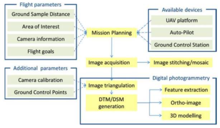
In this Series of notebooks we aim to develop your understanding on the full process from capturing ideal UAV imagery within the law to processing the data and extracting valuable information, specifically classification of land cover.
Majority of this workflow has been adapted from the UKCEH “Drone Habitat Mapping Data Fusion and Classifcation” course.
For anyone working through these notebooks, the principal used software for processing our images is Metashape which is a commercial software package with free demo access. Any information regarding open source alternatives or improved processing steps would of great use to be added to these notebooks.
The Notebook Structure aims to replicate the following typical workflow: